Showing posts with label Reservoirs. Show all posts

Sunday, September 20, 2015

[Reservoir] Upper Seletar Reservoir


After finishing my night shift duties of my last reservist in 2013, I was driving home when I chanced upon this place called Upper Seletar Reservoir. Since time was on my side, I stopped my car and walked towards the reservoir. There was very little frontage for anyone to have a picnic or for cycling. But it was good for those who just need that quiet time.

The place was pretty much devoid of people.

A little history about this reservoir. 

The construction of the Seletar Reservoir started in 1921 and was abandoned by the end of that year, as stated in The Straits Times article dated October 17, 1924.1.  The Seletar reservoir was deemed too expensive to be built  though there were still calls for works to proceed on August 6, 1921. 2 The rush was that there was not enough water for the growing population of Singapore as the supply of water slated to be available from Johore by 1925 was far from possible due to the many delays. 3. 

Still as early as 1922, the beauty and serenity of the reservoir have started to see visitors coming to the place for excursions. 4.

In 1935, though Seletar Reservoir was still not a full-fledged reservoir, it still helped Singapore tide through a dry spell. 5 and in 1937, the government recognised that there was a need for more water and Seletar Reservoir would help to alleviate the issue. 6. 

In 1939 that the government decided to make Seletar a permanent reservoir from one that was used a a temporary measure for water storage. The dam "would be raised by about five feet, increasing the capacity of the area four or five times". 7, 8. Completed in 1940, the reservoir could now hold 150 million gallons of water. 15.   

Due to impending war and Japanese spies who might sabotage the water supply, Seletar Reservoir became a prohibited area in October 1941. 9. 

In 1950, a writer wrote about the three reservoirs in Singapore. He mentioned that Seletar Reservoir was "hardly one of the beauty spots". 10  Interestingly though in 1951, another writer waxed lyrical about the reservoir. 11.

Near Seletar Reservoir, the Ministry of Culture screened free movies at the City Council Quarters to entertain workers who helped manage the reservoir from 1959 onwards. 12. 13. 14. 15.

There was a drought that in 1961 that saw many dead fishes that previously teemed in its pristine waters. 15.
 
With the need to more supply drinking water for the ever growing population, the government forked out $27 million in April 1967 to increase Seletar Reservoir's water storage capacity. 16.

By February 1969, the expansion of the reservoir was finally completed 17 and ready for its Opening Ceremony on 10 August 1969. Princess Alexandra officially opened the reservoir. 16. The Princess was invited here as part of Singapore's 150th anniversary and National Day celebrations. The official programme included a "72-member Methodist Girls School choir and the well-known girls' bag piper". There was also a rowing exhibition by the PUB team and "Koleh sailing by the residents of the Southern Islands". 18.

The reservoir could now hold 5,300 million gallons of water, making it the largest reservoir in Singapore. Part of the development included the valve tower which could be "approached by a six-span foot bridge and is 80 feet high" 16. Located at the reservoir was also a 60 feet viewing tower. 18.

Boat rowing competitions such as the Far East Rowing Regatta  was held at the reservoir in 1970. 19.

First written on January 13, 2013. 


Sunday, August 16, 2015

[Singapore Parks] Mount Emily Park

Signboard of Mount Emily Park
There are more than 300 parks and 4 nature reserves that come under the charge of Singapore's Statutory Board, NParks. Indeed, some parks are less well frequented than others. This can be due to their locality, its facilities or the variety of activities that are organised within the park.

Mount Emily Park is pretty much a quiet old dame of a park that offers nothing more than serenity. Surrounded by private housing, St. Margaret Primary School and the Istana grounds, the park sits on an elevation far beyond the noise of any vehicular movements. Even though the park itself is within the Central Business District.

Behind its quiet facade, the park grounds hold rich history of Singapore's past. Mount Emily was previously known as Bukit Rawa. 

Closer look at the Coat-of-Arms

One of the first structures that you will see at the park is this entrance shelter. Sited in the rock wall of this structure is an emblem of yesteryear. This emblem is a coat of arms granted to the Municipal Commission by the College of Heralds in April 1948. (1)  The colours featured on the coat-of-arms are largely intact and it's such a throwback to see this in person.

Singapore's Coat-of-Arms


It is said that this was the entrance to the former Mt. Emily Swimming Pool. This is where the part about it having a rich history begins.


Reservoir and Mount Emily Swimming Pool

Mt. Emily Reservoir (2)
Mt. Emily once held two service reservoirs that were constructed in the 1880s. But by the late 1920s, the service reservoir was no longer required. It's redundancy was brought upon by the building of the Fort Canning Service Reservoir, which the press claimed to be the largest enclosed reservoir in the East. (3)   

1954 Map from OneMap (4)

The reservoir was then converted into a swimming pool and it was officially opened by Mr R. J. Farrer, President of the Municipal Commissioners on January 10, 1931. (5) The total cost of converting the reservoir into a public swimming pool came up to $30,000. (6) To find out more about Mount Emily Swimming Pool, click here. (7)


Mount Emily Park

Panoramic view of the park


In the early 1900s, Mount Emily Park was seen as a popular retreat of those staying close by. There was a band that played in the afternoon. Parents and children would also spend time playing together. (6)  

Some of the oldest trees seen in the park
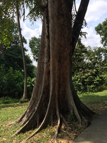
The girth of some of the trees there stood as testament of its glorious days. The age of these trees must have been more than 100 years old.

With such a rich history to this park, surely it must be made into a place of interest for local Singaporeans.


Last updated: August 19, 2015


References


1. Lim, J. November 7, 2014. A crestfallen ghost of the past. The Long and Winding Road. Accessed on August 16, 2015. https://thelongnwindingroad.wordpress.com/tag/singapore-municipal-commission/ 

2. National Archive of Singapore. Accessed on August 16, 2015.  http://www.nas.gov.sg/archivesonline/photographs/record-details/ae41408a-1161-11e3-83d5-0050568939ad

3. The Singapore Free Press & Mercantile Advertiser. September 17, 1929. New Emily Park. P9.

4. OneMap. Accessed on August 16, 2015. http://www.onemap.sg/index.html

5. The Singapore Free Press & Mercantile Advertiser. January 1, 1931. Mount Emily. P20.

6. The Singapore Free Press & Mercantile Advertiser. January 12, 1931. A Big Splash. P20.

7. Mount Emily Swimming Pool. December 20, 2012. Accessed on August 16, 2015. http://rememberingsingapore.blogspot.sg/2012/12/mount-emily-swimming-pool.html


Sunday, February 1, 2015

[Transportation] Bus Depot at Sungei Seletar: What Was on This Land?

Recently, the government had announced that they will be building a bus depot close to Lentor Avenue.It is slated to be completed in 2017. The proposed site is where Lorong Kelopak and Track 24 were located. Lorong Kelopak was first seen in Singapore maps some time around 1969. Both the roads have now been expunged. But really, what was on this land?


I met Mr Chew, 71 who has set up a little shop at the back of his lorry. He was hammering away on metal sheets. He shared that he was making portable BBQ pits and he had in the past, made metallic household items such as metal containers and such. Mr Chew has set up his little business under the Seletar Expressway flyover. He has been there for more than 10 years and was able to provide me with nuggets of information about the place.


1. Illegal Distillery


Those were the days where people are willing to get high on a cheap and they did it through the illegal production of samsu. In 1976, there was a big alcohol bust where 670 litres of self-made alcohol was seized. The customs officers were not able to make any arrest. (1)


2. Chiap Seng Fishing Pond


This popular fishing pond was located at Track 24, Yio Chu Kang. (2) The company ran its own fishing competition as early as the 1950s. (3) The Serangoon Gardens Community Centre had also organised a fishing competition there. (4)

3. Dairy Farm

Mr Chew shared about the dairy farm in the vicinity and true to what he had shared, the largest dairy farm in Singapore was located there. Managed by the North Indian community called Biharis, they first brought over their livestock in the 1900s. The farm was located in Kampong Sungei Seletar. The farm finally saw its last "moo" as their lease of the land had run out. (5) 

4. Lower Seletar Reservoir

The reservoir, formerly known as Sungei Seletar Reservoir, was formed when the river was dammed in 1983. The cost of the dam came up to S$62 million (6) and was completed in 1985. (7) The final naming of the reservoir was given in 1992. (8)

Other than this river being the longest, it is also amongst the oldest place in Singapore where people lived at. I've written about the Orang Seletar community who were present even before the arrival of Sir Stamford Raffles.


5. Indian Temple

Mr Chew said that there is an Indian temple located within the Army training area. He said that the Indian community would usually seek permission from the Army to visit that unmanned temple. 


References

1.Kutty, N. G. August 6, 1976. Customs smash jungle moonshiners. The Straits Times. Page 9.

2. Popular Fishing Pond. July 18, 1982. The Straits Times. Page 9.

3. The Straits Times. July 7, 1959. Advertisement. Page 11.

4. Fishing Competition. November 22, 1978. The Straits Times. Page 8.

5. Chew, Y. F. June 11, 1984. Singapore Cowboys. Singapore Monitor - Afternoon Edition. Page 4.

6. Toh, E. January 7, 1991. Loh & Loh clinches $38m land reclamation deal. The Straits Times. 

7. Reservoir ready. November 6, 1985. The Straits Times. Page 10.

8. Tay, S. C. July 23, 2011. Walk This Way. The Straits Times.

Sunday, January 25, 2015

Top 10 Highest Natural Points in Singapore


Bukit Timah Hill. Standing at a height of 163 metres, it is deemed to be the highest point in Singapore. The second highest point should be Mount Faber then with all of its 106 metres in height. Singapore must also be quite hilly with place names starting with Bukit (Malay word for Hill), Mount and others that are called Hills.

I was also intrigued by the topographical maps that was on display at the National Library of Singapore. So I did a bit of research online and was totally surprised by what I'd found out.

You mean that Mount Faber is not even listed amonst the top 10 tallest location in Singapore? You mean that most of the Bukits. i.e. Bukit Panjang, and even Pearls Hill are not even 100 metres tall? Well, Mount Faber stands at 97 metres while Fort Canning with its rich history that underpins this hill is only about 60 metres.

So where can I find the tallest points in Singapore? Well, here're the top 10 places starting from the lowest.

10. Upper Peirce Hill (129 Metres)


Well, the number 10 hill is located deep in the jungles of the Upper Peirce Reservoir. At the perimeter of the hill are military installation. This makes it pretty impossible to access this hill.


9. Bukit Gombak (132 Metres)


Why does that name sounds so familiar to the army boys? Well, this is where the well fenced-up Ministry of Defence is based. Heritage blogger James Tann 1 has written a wonderful piece about Bukit Gombak. As the most secured hill of all hills, this is surely one that we will not have the opportunity to climb in the near future.


8. Hindhede Hill (134 Metres)


I don't think there's a name for this hill. But We will call it Hindhede Hill  since it's located close to Hindhede Drive. This hill is part of the Bukit Timah Hill range that sees other taller hills standing tall beside it.


7. Sime Road Hill (145 Metres)


Sited in midst of Singapore Island Country Club is 145 metres tall hill. I dubbed it Sime Road Hill as this road hugs the foot of this hill. This hill has seen evil squarely in the face. During the Japanese attack of Singapore in 1942, both the Allied and Japanese troops fought fierce battles here. When the Japanese won the war, the Europeans were interned in a camp along Sime Road. The Sime Road Camp was designated as a heritage site in 2003. 2


6. Singapore Quarry Hill (162 Metres)


Coming in at number 6 is a hill that one can see without needing to climb. This hill forms part of the disused quarry that is now called Singapore Quarry. Granite was extracted by blasting dynamite and the rock face that you see here was once a continuum of Bukit Timah Hill. This place has now been made into a Nature Park.


3, 4 & 5.  Bukit Timah Hill (180 Metres, 170 Metres and 166 Metres)


This is the actual Bukit Timah Hill where climbers will trod their way up the hill and shout hurrah upon reaching the top of the peak, and so I thought it was the peak. Actually, the top of the hill is at 166 Metres and close by, there lies two other peaks ranging from  170 to 180 Metres.


2.  Mandai Hill (180 Metres)


This hill is one of the more inaccessible hill. Locked in by an Expressway and the Upper Seletar Reservoir, you can only enter by walking. BUT! This hill has been set aside for military use and public are not allowed to enter. Talk about wanting to climb the top 3 hills in Singapore! Hmph.

And the number 1 Highest natural point in Singapore is...


1. Chestnut Avenue Hill (190 Metres)


Smacked in the middle of Diary Farm Road and Upper Pierce Reservior, this hill is the tallest that Singapore has to offer. To get to the hill, you will need to access from Chestnut Avenue. From there, it is a pretty long walk in.


References

1. Bukit Gombak Hill. Tann, J. July 21, 2012. http://ijamestann.blogspot.sg/2012/07/bukit-gombak-hill.html (Retrieved on January 25, 2015).

2. Sime Road Camp. Zakaria, F.  http://eresources.nlb.gov.sg/infopedia/articles/SIP_1769_2011-02-14.html (Retrieved on January 25, 2015).

3. ArcGIS. Topographical Map of Singapore. http://www.arcgis.com/home/webmap/viewer.html?webmap=e6d02aae06f442518253c90db4fc1e93 (Retrieved on January 25, 2015).


Sunday, November 23, 2014

[Parks] Lorong Halus: From Landfill to Wetland


Lorong Halus - a far flung corner of Singapore that no one had wanted to visit. The road off the Tampines Expressway was not only a landfill, it was also a place to dispose the unsavoury collection of the nation's night soil. (1) (The "century old night soil bucket system" and its night soil disposal station closed down in 1987) (2)

The "rudimentary  system (was) a poor reflection of poor public health standards (and that) would keep foreign investors away", according to Mr Tan Gee Paw, Chairman of the national water agency, PUB. (5)

There were more gloom linking to this place. Gangsters lurked in various corners and when the government had wanted to re-develop Tanjong Rhu, they moved "more than 40 charcoal dealers" to Lorong Halus.  (3)

The landfill was operational from 1970 to 1999. (4) 

I remember two instances whereby I had a close encounter with the landfill - both times were in 2002, three years after the landfill was officially closed.

The first was my unexpected visit of the place. I'd taken a wrong turn along the expressway and I'd ended up in Lorong Halus. It started of with it being a metal road. But that soon gave way and before I knew it, I was driving on a muddy road with huge tipper trucks coming from all directions! There was also some burning of refuse happening in that area. My mind went "oh-oh". I quickly did an about turn and scooted out of that area.

The second encounter was when I was house-hunting in Punggol. The wife and I were at Punggol Field Road and from where we were, we caught a whiff of the odour which we believe was coming from Lorong Halus. That encounter helped made up our minds. We chose a housing estate two MRT stations down.


Today, the entire Lorong Halus has been transformed into a wetland. Sited next to Serangoon Reservior, the Lorong Halus Wetland was officially opened on March 5, 2011 by Deputy Prime Minister Teo Chee Hean. (5)


How to get there

If you're driving, you can enter via the Tampines Expressway (Exit 7) towards Changi Airport. The exit will lead you towards Lorong Halus.

If you're jogging or cycling, there is also a bridge from Punggol that runs across the Punggol Serangoon River towards the wetlands.


Updated on: September 17, 2015


References

1. Chng, G. July 27, 1984. 88 nightsoil workers to call it a day. The Straits Times. P.11.
2. Death knell of nightsoil buckets. January 24, 1987. The Straits Times. P.17.
3. Charcoal traders move to Tampines. April 21, 1984. The Straits Times. P.10.
4. Raffles Museum of Biodiversity Research. The DNA of Singapore. http://lkcnhm.nus.edu.sg/dna/places/details/19 (Accessed on November 24, 2014)
5. Lin, M. September 17, 2015. PUB Chairman Gets Top Honour for Sewer System. The Straits Times. P.B2

Saturday, October 18, 2014

[Nature] Keppel Hill Reservoir Explored!


A forgotten reservoir; Drowning of a 17 year-old boy (1) and two British soldiers (One of whom was listed as a strong swimmer) (2) in two separate incidents; all these stories added to the mystic of this reservoir when the finding was released to the public on September 17, 2014. (3) It was said that the British were strong swimmers and that they had drowned in the 20-feet (6 metre) deep reservoir. So what happened there? Also, the people who stayed at the foot of Keppel Hill must have known about this reservoir - This include the dwellers of Kampung Bukit Nong, (4) and the Singapore Harbour Board employees who were slum dwellers there. (5)

After its announcement in the newspaper recently, hundreds of history and heritage lovers started to throng the site. The National Heritage Board also invited Mr Charles Goh, who first stumbled upon the reservoir in 2005, to lead the guided tours. (6)


The reservoir dates back to 1905 and was used as a source of water for the Tanjong Pagar Dockyard. (3) I'm sure some of the findings such as the rough bricks and its surrounding, will unravel more information about this forgotten reservoir. To get to the reservoir, one needs to enter through Wishart Road and walk east past Joaquim Garden Landscape flora company.


After a bend, the road will come to a dead-end. From there, you will need to go through the forest and also cross a small river before arriving at the reservoir.


The first view that greeted me was one greenish murky water body. Uprooted tree branches laid in the water, while brown leaves covered parts of the water, truly giving the place a feeling of abandonment.


Panning the the right, there was a modern-day pipe installed by the flora company that draws water from the reservoir to water their plants. So in fact, the place was not unknown, only the history of the reservoir might have been laid hidden. There were also two metal rods that had once uphold the wooden dive board.


In the past, visitors of this reservoir and afterwhich swimming pool, had other ways of getting to the water other than using the spring board.  Cement steps allows one to dip one's toes into the water to test its chill factor.


So what happen if the water starts to rise uncontrollably after a heavy shower? Well, the builder of the reservoir has included spillway to allow for access water to flow out of the reservoir. All of this are so well thought out.


Finally, here's a video produced by the National Heritage Board before the reservoir was made known to public.

There was a mention in the newspaper that may see the development of the foothills of Mount Faber, that includes Keppel Hills. (7) So will that mark the beginning of the end for this reservoir?


References

1. Youth drowned in reservoir. (April 4, 1948). The Straits Times. P3.

2. Misadventure verdicts in double drowning tragedy. (April 17, 1936). The Singapore Free Press and Mercantile Advertiser. P3.

3. Zaccheus, M. (September 17, 2014). Abandoned reservoir off Telok Blangah Road discovered. The Straits Times. Accessed October 21, 2014.
Abandoned reservoir off Telok Blangah Road discovered - See more at: http://www.straitstimes.com/news/singapore/more-singapore-stories/story/abandoned-reservoir-telok-blangah-road-discovered-201409#sthash.bweUFQVA.dpuf
http://www.straitstimes.com/news/singapore/more-singapore-stories/story/abandoned-reservoir-telok-blangah-road-discovered-201409

4. He sneaked out for a dip in pool when his grandfather was caretaker. (September 23, 2014). The Straits Times. Accessed October 21, 2014.

5. Over 270 leave the slums. (September 15, 1952). The Straits Times. P7.

6. Zaccheus, M. (September 23, 2014). Free tours of forgotten Keppel Hill Reservoir to be conducted. The Straits Times. Accessed October 21, 2014.
Abandoned reservoir off Telok Blangah Road discovered - See more at: http://www.straitstimes.com/news/singapore/more-singapore-stories/story/abandoned-reservoir-telok-blangah-road-discovered-201409#sthash.bweUFQVA.dpuf
http://www.straitstimes.com/news/singapore/more-singapore-stories/story/free-tours-forgotten-keppel-hill-reservoir-be-conducted-

Free tours of forgotten Keppel Hill Reservoir to be conducted - See more at: http://www.straitstimes.com/news/singapore/more-singapore-stories/story/free-tours-forgotten-keppel-hill-reservoir-be-conducted-#sthash.sCiwhFjP.dpuf
7. Wang, J. & Lim, W. C. (August 15, 2007). Mt Faber foothills slated to be next lifestyle hot spot.
The Straits Times. P3.

Wednesday, August 13, 2014

[Singapore Islands] Pulau Punggol Barat and Pulau Punggol Timor


In a magical instance, two islands rose from the sea. Well in the case of Pulau Punggol, it was not quite so magical. It was through an announcement in 1995 that the public came to know of the two reclaimed islands off Seletar - Pulau Punggol Barat and Pulau Punggol Timor, or West Punggol Island and East Punggol Island. 1

Pulau Punggol Timor was initially used as a military exercise ground from 1998-99. 2


In 2007, it was announced that these islands were to be used as a landing and stockpile site for granite and sand. 3  I've read much about this place and so with my trusty bicycle, I took the road less travelled. I was a bit more careful and had chosen to cycle along the path rather than on the road. It seemed like there was an endless stream of tipper trucks.


They were moving sand and granite to the various locations around Singapore, all in the name of urbanisation and the building of government flats and other other developments.

Pulau Punggol Timor  
   
My cycling trail started at Punggol Way. I'd crossed the bridge that cuts through Sungei Punggol. The first building that you will get to see is this weathered building that house the dam gates for this river. The bridge led me to Pulau Punggol Timor where you can find the landing and stockpile sites. These sites could be seen all over this island.


In a short 15 minutes, I was able to get to the bridge that led me from Pulau Punggol Timor to Pulau Punggol Barat.

Pulau Punggol Barat


It was more cycling from here. However, this island now sees more vegetation that Pulau Punggol Timor. This island also see a 3.7 Kilometre long fence to deter illegal immigrants from landing on this island. It has happened before. 3


Moving along, there were also lovely flowers that laid spread out on the pavement. The excitement was growing and I'd really want to see what's at the end of Pulau Punggol Barat. A bridge linking to the outskirt of the Seletar Airport was all that I had wanted to see.


Paddling the gradual slope was most satisfying when I caught sight of the surroundings. On my left, was the edge of the island. On the right was Seletar Airport, and behind me was a true bonanza.


That is the elevated view of Pulau Seletar. Paradise.


1. Tan, H. Y. (November 22, 1995). Singapore islands get new names with reclamation. The Straits Times. P.3.

2. Military Exercise. (February 14, 1999). The Straits Times. P21.

3. How police deter smugglers at hotspots. October 2, 2010.